Dublin
North Bull Island
(2006-07-19)
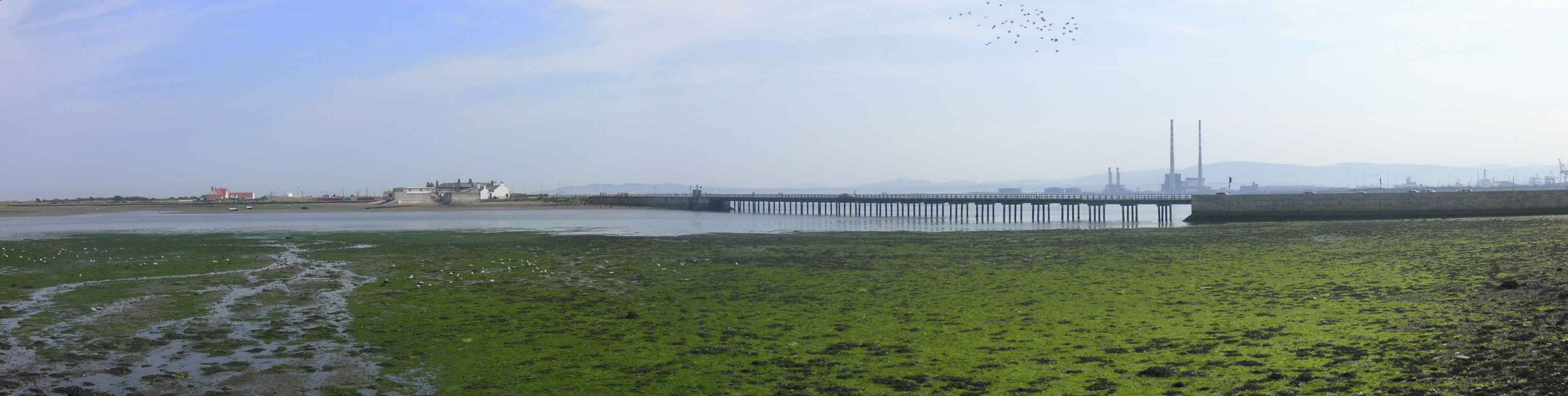
1825 wurde die North Bull Mauer fertiggestellt, die den Hafen von Dublin gegen Versandung schützt. Da der Sand aber irgendwohin musste, lagerte er sich immer mehr an einer kleinen Sandbank ab, die schließlich zu North Bull Island wurde. Die Insel ist heute fünf Kilometer lang und knapp einen Kilometer breit. Sie ist Irlands erstes Vogelschutzgebiet (1931), seit 1981 eine U.N.E.S.C.O. Biosphäre und auch Heimat seltener Tiere und Pflanzen.
Von Clontarf aus führt ein hölzerner Steg (1907) auf die Insel. Vom Steg aus können wir die Stadt sehr schön sehen, sogar die Gipfeln der Wicklow Berge zeichnen sich am Horizont ab. Auf der Insel gibt es nur wenige Häuser - aber wo wollen dann all die Autos hin, die uns am Weg überholen?
In 1825 the North Bull Wall was finished that protects Dublin harbour against silting. But because the sand had to go somewhere, it gathered around a small sand bank that finally became North Bull Island. Today the island is five kilometres long and almost one kilometre in width. It is Ireland's first National Bird Sanctuary (1931), since 1981 a U.N.E.S.C.O. Biosphere and also home to many rare animals and plants.
From Clontarf a wooden bridge (1907) crosses to the island. From the bridge we have a good view of the city, even the peaks of the Wicklow Mountains loom on the horizon. On the island there are only a few houses - but where are all the cars going that pass us along the way?
North Bull Island im Detail / Expand on North Bull Island

Zugeordnete Themen / Assigned Topics:
Mehr Informationen über - North Bull Island / More information about - North Bull Island
Lage / Location
Irish grid: O 21070 36005
Übersicht über Dublin / Overview of Dublin


(© OpenStreetMaps contributors)