Lough Swilly
(2017-07-23)
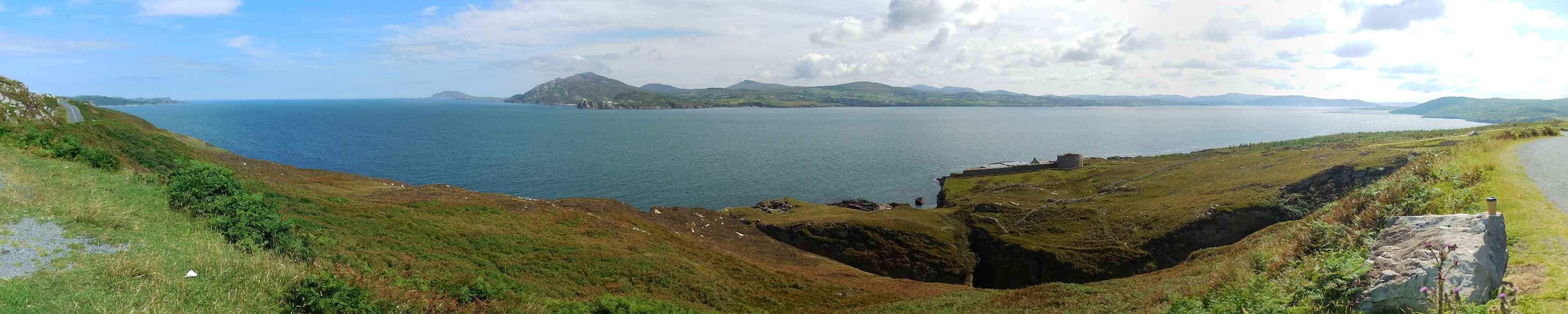
Eigentlich ist der Lough Swilly (Loch Súilí, See der Augen) kein See, sondern ein Meeresarm. Es ist einer von drei Fjorden in Irland, die von Gletschern ausgeschliffen wurden. (Die beiden anderen sind Killary Harbour und Carlingford Lough.) Der Lough erstreckt sich etwa 45 Kilometer von Letterkenny im Süden, wo die Swilly in ihn mündet, bis zum Fanad Head im Norden. Das Land um den See ist seit der Steinzeit besiedelt, aus dieser Zeit gibt es noch einige megalithische Bauwerke. Knockalla Fort und der Martello Turm, zum Schutz gegen Napoleon erbaut, zeugen davon, dass der See auch immer wieder Schauplatz militärischer Auseinandersetzungen war. Heute kämpfen hier nur mehr Angler gegen ihre Beute.
Actually, Lough Swilly (Loch Súilí, Lake of the Eyes) is no lake, but a firth. It is one of three fjords in Ireland that have been ground out by glaciers. (The two others are Killary Harbour and Carlingford Lough.) The lough stretches for about 45 kilometres from Letterkenny in the south, where the river Swilly flows into it, to the Fanad Head in the north. The land around the lough has been inhabited since the Stone Age, from that time several Megalithic monuments still remain. Knockalla Fort and the Martello tower, built for protection against Napoleon, are proof that the lough has again and again been the stage of military conflicts. Today, the only fighting that takes place are fishing men against their haul.
Zugeordnete Themen / Assigned Topics:

Mehr Informationen über - Lough Swilly / More information about - Lough Swilly
Lage / Location
Irish grid: C 26924 37089


(© Wiki Commons)