Kells
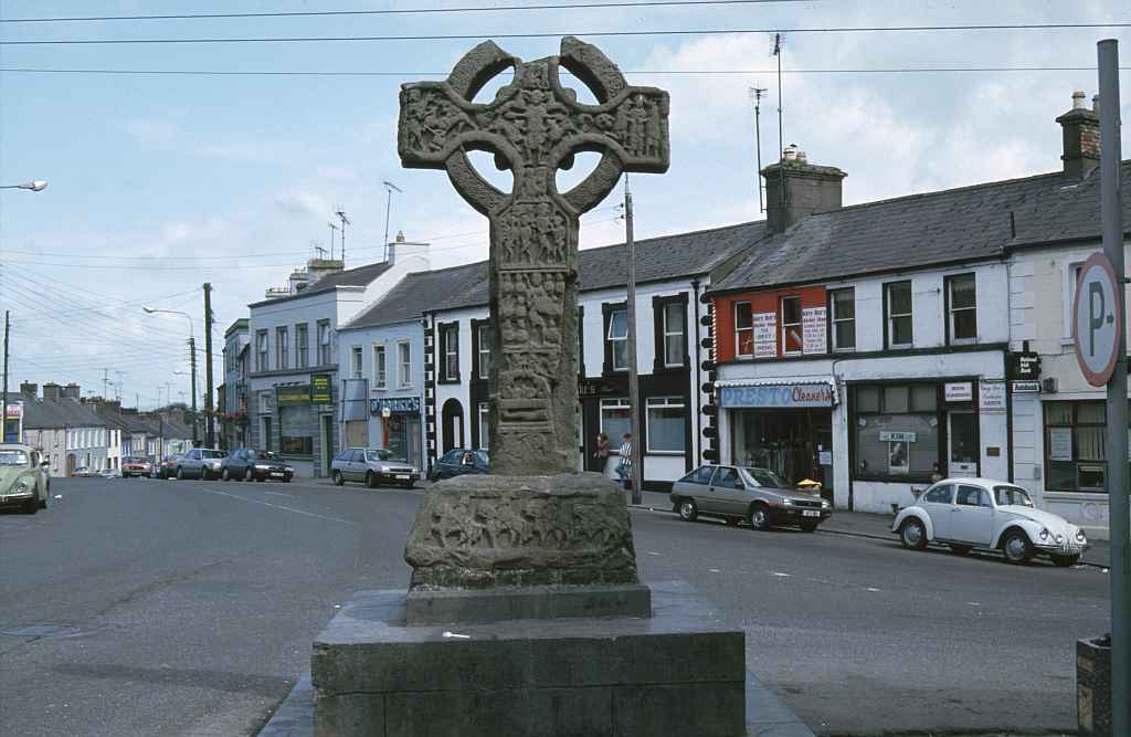
Hochkreuz am Marktplatz / Market Place Cross
(1994-08-01)
In Kells (Ceanannas) wurde im 6. Jahrhundert vom Hl. Columba ein Kloster gegründet, das im Mittelalter eines der großen Zentren des keltischen Christentums war. Noch heute sind hier fünf Hochkreuze zu bewundern, im Bild das am Marktplatz, das früher am Osttor des Klostergeländess stand. Während der Rebellion 1798 wurde es als Galgen benutzt. Das Bild zeigt das Kreuz noch auf seinem alten Standort an der Kreuzung von Market Street, Castle Street, John Street und Farrell Street, heute steht es vor dem alten Gerichtsgebäude.
In Kells (Ceanannas) St. Columba founded a monastery in the 6th century, that was one of the great centres of Celtic Christianity during the Middle Ages. Even today five crosses can be admired, the one in the picture once stood at the eastern gate of the monastic area. It was used as a gallows during the 1798 rebellion. The picture shows the cross at its old location on the crossing of Market Street, Castle Street, John Street and Farrell Street; today it stands in front of the old Courthouse.
Kells im Detail / Expand on Kells
 Rundturm und unvollendetes Hochkreuz / Round Tower and Unfinished High CrossHochkreuz von Patrick und Columba / High Cross of Patrick and ColumbaUnvollständiges Hochkreuz / Incomplete High CrossKirche zum Hl. Columba / St. Columba's ChurchGlockenturm / Bell TowerHaus des Hl. Columba / St Columba's HouseBuch von Kells / Book of KellsDas fünfte Hochkreuz / The Fifth High Cross
Zugeordnete Themen / Assigned Topics:
Mehr Informationen über - Kells / More information about - Kells
Lage / Location
Irish grid: N 74170 75840


