Anhoehe von Uisneach / Hill of Uisneach
(2006-07-22)
Erst bei unserem zweiten Besuch in der Gegend gelingt es uns den Weg auf die Anhöhe von Uisneach zu finden. Die Anhöhe ist von historischer Bedeutung, die bis in die La Tène Zeit zurückgeht. Hier war einst der Sitz des Hochkönigs von Irland, und zahlreiche Überreste von Steinforts und Grabhügel können hier gefunden werden.
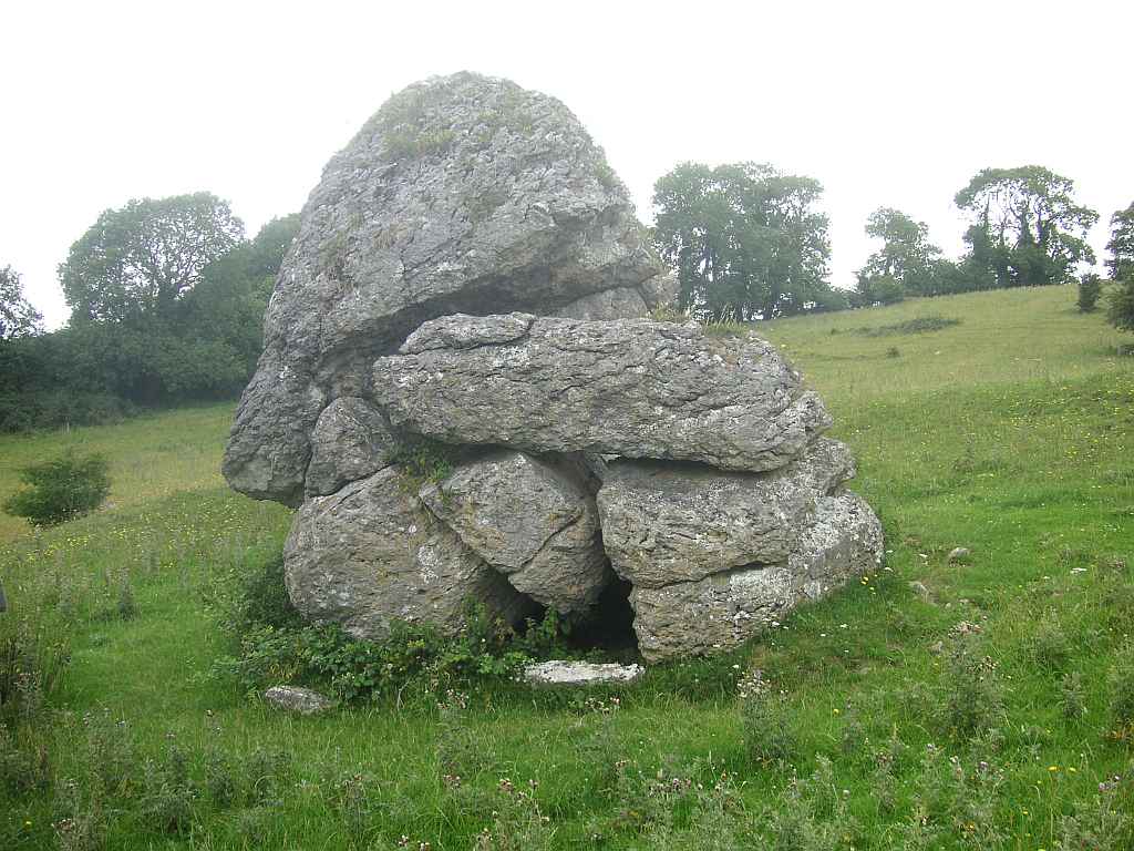
Das bekannteste Gebilde von Uisneach ist jedoch der Katzenstein, benannt weil er aussehen soll, wie eine Katze, die auf eine Maus lauert. Fast sechs Meter hoch, über 30 Tonnen schwer - und er soll die Mitte Irlands und den Treffpunkt der Provinzen markieren. Außerdem soll man an einem klaren Tag von hier aus bis in 14 Grafschaften sehen können. (Aus Ermangelung eines klaren Tages können wir das aber nicht überprüfen.)
Not before our second visit at this place did we manage to find the path up the Hill of Uisnaech. The hill is of historical importance, going back to the La Tène age. Here was the seat of the Highking of Ireland, and many remains of stone forts and tumuli can be found.
The most famous structure of Uisneach is the Cat Stone, named so because it shall resemble a cat watching for a mouse. Almost six metres high, weighing over 30 tons - and it is said to be the centre of Ireland and marking the coming together of the provinces. Further, it shall be possible to see on a clear day into 14 counties. (But due to the lack of a clear day we cannot verify that.)
Zugeordnete Themen / Assigned Topics:

Mehr Informationen über - Anhöhe von Uisneach / More information about - Hill of Uisneach
Lage / Location
Irish grid: N 28891 48608


(© Wiki Commons)