Wicklow Berge - Sally Gap / Wicklow Mountains - Sally Gap
(2017-07-13)
Die Wicklow Berge (Sléibhte Chill Mhantáin) sind ein beliebtes Ausflugsziel der Dubliner. Die sanften, teilweise bewaldeten Anhöhen vermitteln eine Ruhe, die in der Millionenstadt Dublin schwer zu finden ist.
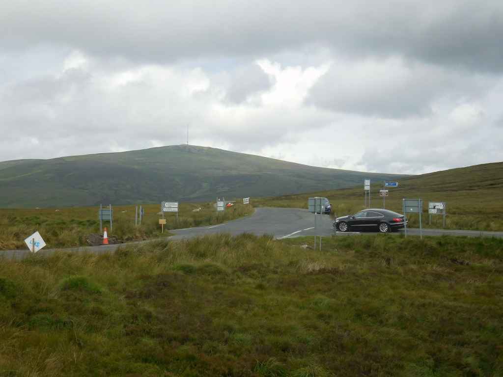
Früher waren die Wicklow Berge aber schwer zugänglich und die Clans der O'Tooles und O'Byrnes zogen sich in die Täler zurück, von wo sie aus immer wieder Angriffe auf die englischen Stellungen bis hinauf nach Dublin unternahmen. Nach der Rebellion von 1798 bauten die Briten eine Straße quer durch die Berge, um ihre Truppen rascher zu den Verstecken der Rebellen bringen zu können. Diese Militärstraße (An Bóthar Míleata) ist heute die R115, die beim Sally Gap die R759 kreuzt. Vor hier aus ist auch der Berg Kippure gut zu erkennen, der mit 757 Metern die höchste Erhebung der Grafschaft Dublin und durch die Antenne eindeutig erkennbar ist.
The Wicklow Mountains (Sléibhte Chill Mhantáin) are a popular destination for trips, especially for people living in Dublin. The soft, partially wooded heights convey a calmness that is hard to find in the big city of Dublin with its population of one million.
However, in former times the Wicklow Mountains were hard to access and the O'Toole and O'Byrne clans redrew to its valleys, from where they started their attacks on English posts even as far as Dublin. After the rebellion of 1798 the British built a road across the mountains so that they could move their troops much quicker to the rebel hideouts. That Military Road (An Bóthar Míleata) is today the R115 which crosses the R759 at the Sally Gap. From here we have a good look on the mountain Kippure, which is with 757 metres the highest peak in the County Dublin and due to its anntena easily recognizable.
Zugeordnete Themen / Assigned Topics:

Mehr Informationen über - Wicklow Berge - Sally Gap / More information about - Wicklow Mountains - Sally Gap
Lage / Location
Irish grid: O 13000 11000


(© Wiki Commons)
- BD
- Ballybrack Dolmen
- BR
- Bray
- CG
- Carrickgollogan Dolmen
- EN
- Enniskerry
- GD
- Tal der Dodder / Glen Dodder
- GD
- Glaskenny-Onagh Grabanalge / Glaskenny-Onagh Megalithic Tomb
- GM
- Glenmacnass Wasserfall / Glenmacnass Waterfall
- KR
- Killruddery Haus und Gärten / Killruddery House and Gardens
- LB
- Lough Bray Lower
- LH
- Liffey Head Bridge
- LT
- Lough Tay
- PC
- Powerscourt Gardens
- RW
- Roundwood
- SL
- Großer Zuckerhut / Great Sugar Loaf
- VR
- Vartry Reservoir
- WG
- Wicklow Pass / Wicklow Gap