Lough Tay
(2003-08-15)
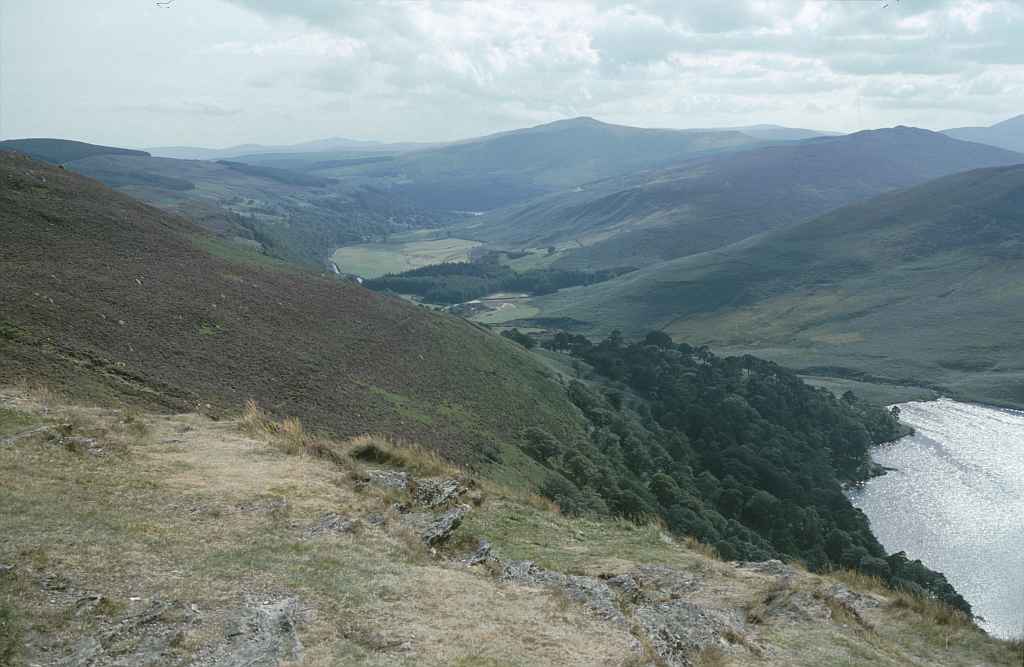
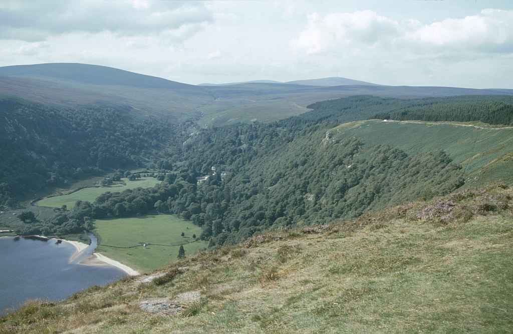
Südlich des Sally Gaps befindet sich ein Aussichtspunkt, von dem wir auf den Lough Tay hinab sehen können. Am Ende des Tals ist ein kleines Stück Land auf dem ein Haus steht. Für uns hat es den Eindruck, als ob dieses Haus nur mittels Boot oder Kletterausrüstung erreichbar wäre. Das ist Abgeschiedenheit pur (wenn man von den neugierigen Blicken der Besucher oben am Aussichtspunkt absieht).
To the south of Sally Gap is a viewpoint from which we can see down to Lough Tay. At the end of the valley, on the last piece of land, a little house resides. From up here it looks like this house can only be reached by boat or by climbing. Now this is seclusion in its purest form (except for the curious glances of the visitors high up at the viewpoint, of course).
Zugeordnete Themen / Assigned Topics:

Mehr Informationen über - Lough Tay / More information about - Lough Tay
Lage / Location
Irish grid: O 16130 07685


(© Wiki Commons)
- BR
- Bray
- CG
- Carrickgollogan Dolmen
- EN
- Enniskerry
- GD
- Glaskenny-Onagh Grabanalge / Glaskenny-Onagh Megalithic Tomb
- GL
- Glendalough
- GM
- Glenmacnass Wasserfall / Glenmacnass Waterfall
- KR
- Killruddery Haus und Gärten / Killruddery House and Gardens
- LB
- Lough Bray Lower
- LH
- Liffey Head Bridge
- MU
- Mount Usher Gardens
- PC
- Powerscourt Gardens
- RD
- Redford
- RW
- Roundwood
- SG
- Wicklow Berge - Sally Gap / Wicklow Mountains - Sally Gap
- SL
- Großer Zuckerhut / Great Sugar Loaf
- VR
- Vartry Reservoir
- WG
- Wicklow Pass / Wicklow Gap