Newry Fluss-Bereich Richtfeuer / Newry River Range Leading Lights
(2015-06-03)
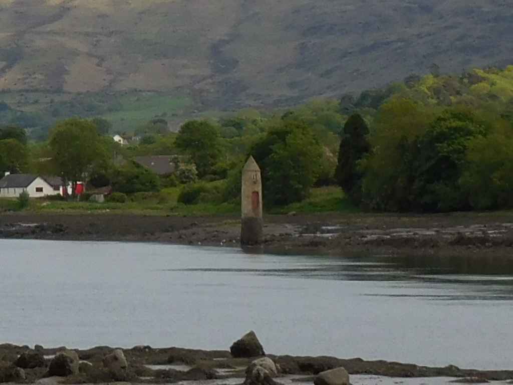
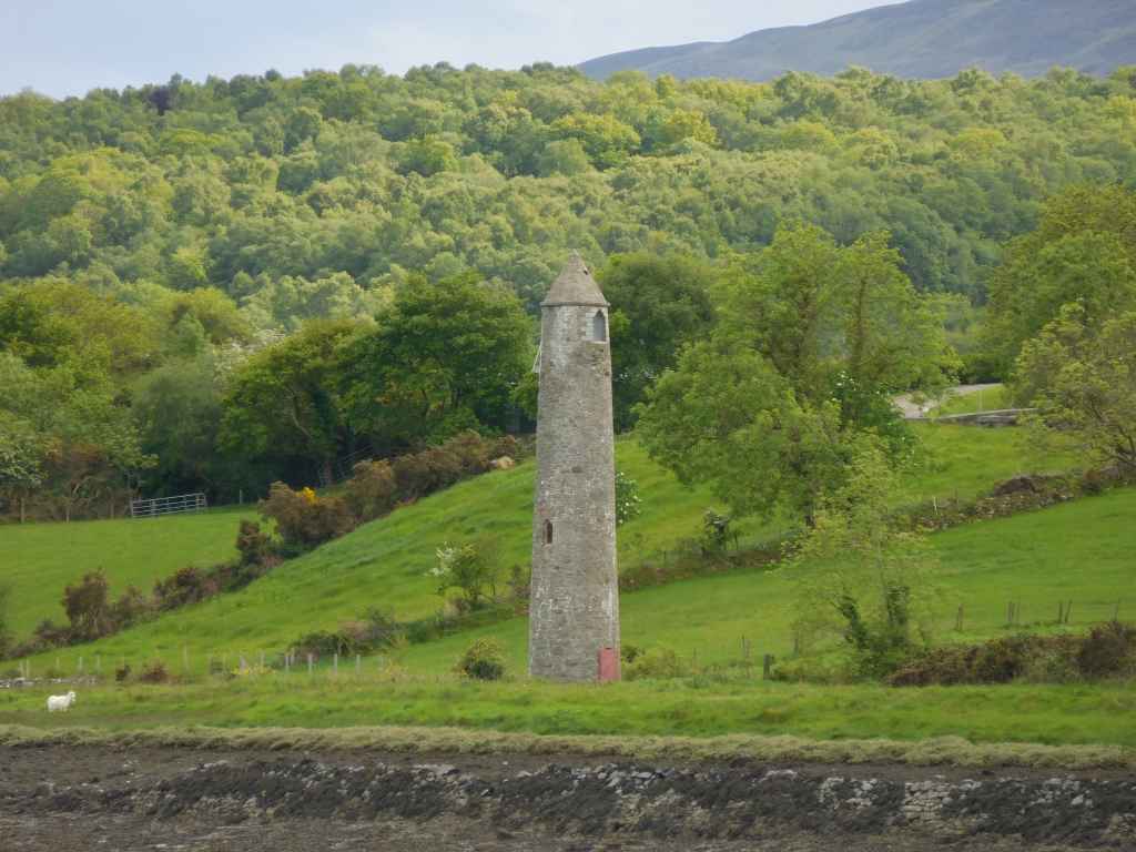
Als wir in Warrenpoint anhalten, um zu fotografieren, fallen uns auf der anderen Seite des Flusses Newry zwei Rundtürme auf. Sie sind untypisch - zu nahe am Wasser, kein Kloster in der Nähe, einer hat einen Eingang auf Bodenniveau. Das Internet bringt dann die Erleuchtung (siehe Link bei den weiterführenden Informationen): Es handelt sich nicht um Rundtürme, sondern um das Unter- und Oberfeuer eines Richtfeuers.
When we stop in Warrenpoint to take photos, we notice two round towers on the other side of the Newry River. They are most untypical - too close to the water, no monastery close by, one has an entrance at ground level. The Internet finally brings enlightenment (see link at further information): They are not round towers at all, but the front and rear light of a leading light.
Zugeordnete Themen / Assigned Topics:

Mehr Informationen über - Newry Fluss-Bereich Richtfeuer / More information about - Newry River Range Leading Lights
Lage / Location
Irish grid: J 12688 19312


(© Wiki Commons)
- AD
- Aghnaskeagh Ganggräber / Aghnaskeagh Portal Tombs
- BD
- Ballykeel Portal Tomb
- CF
- Carlingford
- CP
- Cooley Halbinsel / Cooley Peninsula
- DD
- Dundalk
- GR
- Greenore
- HF
- Anhöhe von Faughart / Hill of Faughart
- KI
- Kilnasaggart Gravurstein / Kilnasaggart Inscribed Stone
- MC
- Moyry Turmhaus / Moyry Castle
- PK
- Proleek Dolmen und Ganggrab / Proleek Dolmen and Tomb
- TS
- Cooley Point - Templetown Strand
- WP
- Warrenpoint